
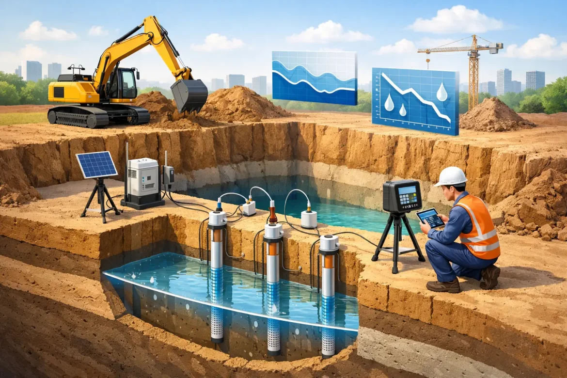
Groundwater control is only effective when the site team can demonstrate what the water table is doing, where the influence of pumping extends and whether the excavation remains stable. An excavation drawdown monitoring guide gives project teams a practical framework for turning pumping data and groundwater readings into timely decisions. It is not simply a reporting exercise. It is how a dewatering system is checked against the conditions it was designed to manage.
For civil, construction and mining works, inadequate monitoring can leave a project exposed to wet excavation bases, unstable batters, piping, excessive settlement beyond the works and unplanned impacts on nearby services or structures. Conversely, pumping harder than necessary can increase operating cost, complicate discharge management and potentially widen the area of influence. The objective is controlled drawdown: enough to protect the works, without creating avoidable risk.
What drawdown monitoring needs to prove
Drawdown is the reduction in groundwater level caused by pumping. On an active excavation, the key question is rarely whether a pump is running. The question is whether groundwater levels have reduced to the required elevation and are remaining there as excavation progresses.
A monitoring programme should provide evidence of four things: the initial groundwater condition, the response to pumping, the groundwater level within and around the excavation, and any movement or water-quality changes that require action. The required detail depends on ground conditions, excavation depth, nearby assets, environmental approvals and the consequences of system failure.
In permeable sands and gravels, groundwater can respond quickly to wellpoint or deep-well pumping. In lower-permeability silts, clays or weathered rock, the response may be slower and less uniform. A reading from one monitoring point cannot automatically be assumed to represent the full excavation. The monitoring layout must reflect the ground model, not just the convenience of accessible locations.
Start with a defensible baseline
Baseline readings should be established before dewatering begins. Ideally, water levels are measured across more than one period, particularly where rainfall, tides, seasonal recharge, nearby pumping or surface-water connections may influence groundwater levels.
Each monitoring point needs a clear reference elevation. Readings taken from the top of casing are useful only when that casing level has been surveyed and consistently recorded. Relating groundwater data to the project datum allows the team to compare measured levels with excavation formation level, temporary works requirements and design drawdown targets.
The baseline record should also capture bore construction, screen depth, ground conditions where known, instrument type and any observed water-quality characteristics. This matters because a shallow standpipe and a deeper piezometer can report different hydraulic conditions at the same location. Treating them as interchangeable can lead to the wrong interpretation of drawdown performance.
Before work starts, agree on the required drawdown level and the acceptance criteria. A common operational requirement is to maintain groundwater below formation level by an agreed safety margin, but the appropriate margin depends on soil type, uplift risk, excavation geometry and the temporary works design. Where base heave, boiling or piping is a concern, the control level may need to be more conservative.
Set up monitoring points around the risk
Monitoring points should be located to answer practical site questions. Internal points show whether the excavation is dry enough to work safely. Perimeter points show how the dewatering system is influencing surrounding ground. Additional points may be required between the excavation and sensitive receptors such as retained structures, existing utilities, waterways or neighbouring works.
A well-designed network commonly includes:
- monitoring points within or immediately adjacent to the excavation;
- points around the perimeter, particularly near deeper cuts and known permeable zones;
- points between pumping wells and nearby assets that could be affected by settlement; and
- designated reference points outside the expected drawdown zone, where site conditions allow.
The right density is project-specific. A shallow services trench in uniform sand requires a different approach to a deep basement excavation beside existing infrastructure, or a mine excavation affected by layered geology. The layout should be reviewed as the works move into new ground conditions or the excavation footprint changes.
Manual dip readings remain valuable because they are simple, repeatable and allow visual inspection of the monitoring point. Pressure transducers and telemetry can provide higher-frequency data and early warning where water levels can change rapidly or where continuous oversight is needed. Automated systems do not remove the need for field checks. A damaged cable, blocked screen or incorrectly referenced logger can produce convincing but misleading data.
This excavation drawdown monitoring guide in practice
The monitoring schedule should match the risk and the stage of work. Before pumping, readings may be taken daily or at defined intervals to establish the baseline. During system commissioning, more frequent readings are often required because this is when poor well performance, air leaks, blocked filters, insufficient pump capacity or unexpected recharge are most likely to become apparent.
Once stable drawdown is achieved, monitoring frequency can be adjusted to the excavation risk, the reliability of the system and the consequences of a rising water level. High-risk excavation stages, rainfall events, pump outages, power interruptions and changes to pumping configuration warrant increased observations. The team should also record pump run hours, flow rates where available, fuel use, rainfall and discharge conditions alongside groundwater levels. These records often explain changes that a water-level graph alone cannot.
A useful daily record identifies the date and time, monitoring point, water level, reference datum, instrument used, pump status, weather conditions and any site observations. Include notes such as turbid discharge, sand production, damaged risers, unusual vibration, wetting at the excavation face or loss of suction at a wellpoint header. Those details can be the first sign that the system is no longer performing as intended.
Data should be plotted as trends rather than left as isolated numbers in a spreadsheet. A graph of groundwater elevation against time quickly shows whether levels are declining, holding steady or recovering. Comparing multiple points can identify uneven drawdown, a local recharge pathway or a pumping well that is losing efficiency.
Use trigger levels that lead to action
Monitoring has limited value if the response to an adverse reading has not been agreed in advance. Trigger and action levels should be set in the dewatering management plan and understood by the dewatering crew, site supervisor and relevant project representatives.
For example, an alert level may require increased inspection and confirmation of pump operation. An action level may require additional pumping capacity, repair of a header line, well rehabilitation, reduced excavation activity or review by the temporary works and geotechnical teams. A stop-work threshold may be appropriate where rising groundwater could compromise formation stability, expose workers to unsafe conditions or create a risk of ground movement.
The precise thresholds depend on the design. They should not be copied from another project without checking the excavation depth, soil profile, hydraulic conductivity, nearby receptors and permitted discharge arrangements. The most effective trigger system is clear enough for a supervisor to act on at 6 am, before a small water-level change becomes a programme issue.
Read the signs beyond water level
A satisfactory drawdown reading does not automatically mean all risks are controlled. The site team should inspect the excavation and discharge system for physical evidence of changing conditions. Softening at formation, seepage through faces, sand migration, cracks near the excavation, settlement around services, unusually turbid water and erosion at the discharge point all deserve investigation.
Settlement monitoring may be required where groundwater lowering could affect adjacent assets. This is particularly relevant in variable alluvial ground, near older structures and where fine soils may consolidate as pore water pressures reduce. In these cases, groundwater monitoring, survey monitoring and pumping records should be reviewed together. One dataset rarely provides the full picture.
Water quality also matters. If extracted groundwater is being discharged, reused or treated, changes in turbidity, pH, salinity, hydrocarbons or other contaminants can affect the approved management approach. A sudden change can indicate that the intake is drawing from a different zone, a bore screen has been compromised or site conditions have changed.
Keep the system ready for failure conditions
Dewatering systems should be monitored for resilience, not only normal performance. Pumps fail, power is interrupted, floats foul, hoses split and heavy rainfall can exceed the assumptions made during setup. Contingency pumps, standby power where required, high-level alarms and clearly assigned call-out responsibilities reduce the time between a fault and a controlled response.
At Dewatering Solutions, monitoring is treated as part of operating the system, not an administrative task completed after the shift. The data informs adjustments to pumping, supports environmental and project reporting, and gives the principal contractor a clearer basis for managing excavation risk.
Good drawdown monitoring gives site teams confidence to keep moving when conditions are stable and a clear warning when they are not. When the readings, observations and response plan are connected, groundwater control becomes a disciplined part of delivering safe, productive excavation works.